Blog·Open Source
28 October 2026
DeathSpot: a community-led danger map, built in the open
Knowledge about dangerous places is scattered across WhatsApp groups, X threads and word of mouth. DeathSpot puts it on one shared, moderated map anyone can check before they travel.
When something dangerous happens on a road in Kampala, people warn each other. But those warnings live in WhatsApp groups, X threads and conversations, and they're hard to find when you need them most.
DeathSpot brings that knowledge onto one shared, moderated map. The goal is informed movement, not fear.
Two taps to report
Anyone can report a dangerous spot in two taps, without an account: drop a pin, choose what happened and when the place is dangerous.
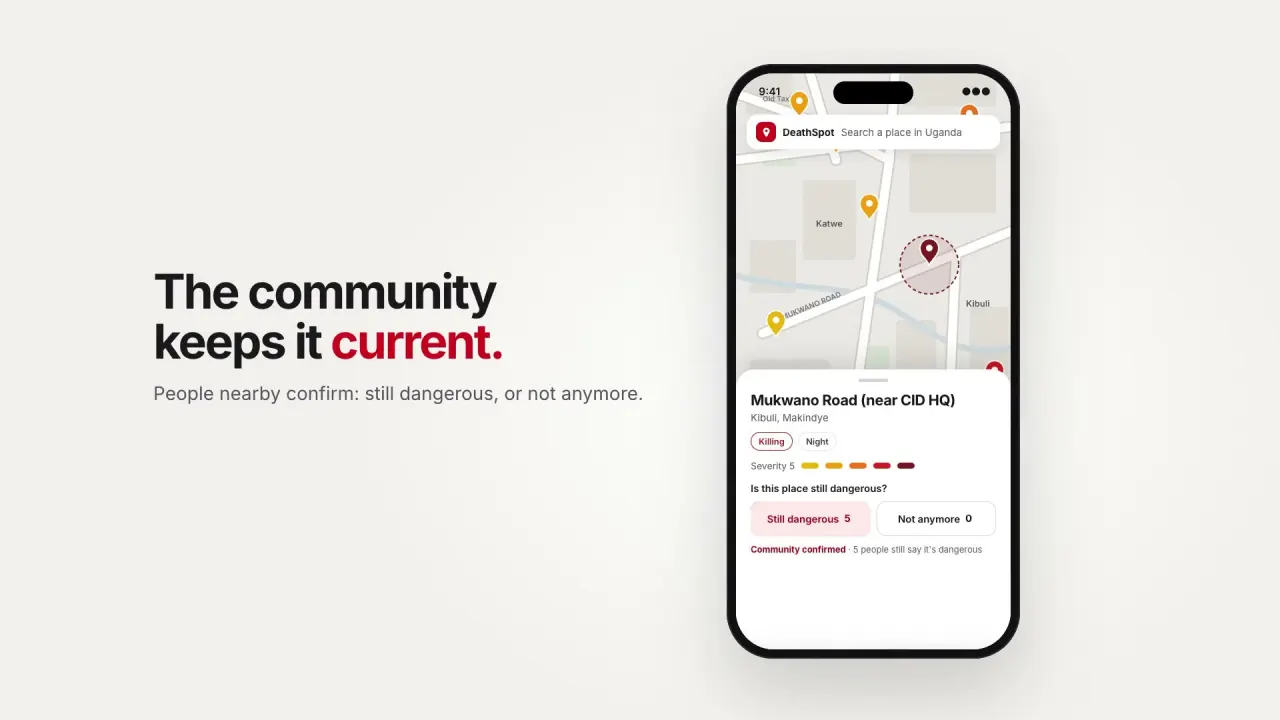
The community keeps it current
Like Waze, but for danger. People nearby confirm a spot is still dangerous or mark it not anymore, so the map stays honest over time.
Check the route first
Route check shows every reported spot within 150 metres of each route, safest route first. Alerts warn you when you're within 300 metres of a reported spot, and a one-tap SOS sheet puts 999 and 112 a tap away.
Open to everyone
DeathSpot is MIT licensed, with public documentation and an API. Read the code, run your own instance or help shape the roadmap on GitHub, or open the map at deathspot.org.